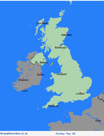
Weather Warnings UK


00:00-06:00

06:00-12:00

12:00-18:00

18:00-24:00


Severe Weather Warnings: Thunderstorms
issued by the Metoffice at
09:01, 02.05.2024
valid from
20:00, 01.05.2024
until
08:00, 02.05.2024
Region: Wales
Spells of heavy rain are expected this evening and overnight. In some places, most likely over northern and eastern parts of the warning area, there is a chance that rain will be accompanied by thunderstorms and frequent lightning. 20 to 40 mm of rain is expected to fall quite widely with 50 mm possible in a few places. In some places much of this rain may fall over a 2 or 3 hour period. What should I do? Consider if your location is at risk of flash flooding. If so, consider preparing a flood plan and an emergency flood kit. Give yourself the best chance of avoiding delays by checking road conditions if driving, or bus and train timetables, amending your travel plans if necessary. People cope better with power cuts when they have prepared for them in advance. It’s easy to do; consider gathering torches and batteries, a mobile phone power pack and other essential items. If you find yourself outside and hear thunder, protect yourself by finding a safe enclosed shelter (such as a car). Do not shelter under or near trees, or other structures which may be struck by lightning. If you are on an elevated area move to lower ground. Be prepared for weather warnings to change quickly: when a weather warning is issued, the Met Office recommends staying up to date with the weather forecast in your area.
Chief ForecasterHeavy rain is expected, with a chance of thunderstorms, leading to travel disruption and some flooding.
The public is advised to take extra care, further information and advice can be found here: http://www.metoffice.gov.uk/weather/uk/links.html
Severe Weather Warnings: Thunderstorms
issued by the Metoffice at
09:01, 02.05.2024
valid from
12:00, 02.05.2024
until
23:59, 02.05.2024
Region: Wales
While some areas will remain remain dry, thunderstorms are likely to develop this afternoon and evening from the east and move relatively slowly westwards or northwestwards. Where thunderstorms occur, heavy rain accompanied by frequent lightning is likely with potential for 25 to 30 mm of rain to fall in 1 or 2 hours in a few places and perhaps as much as 50 mm could fall in one or two spots. In a few places there may also be some hail. What should I do? Consider if your location is at risk of flash flooding. If so, consider preparing a flood plan and an emergency flood kit. Give yourself the best chance of avoiding delays by checking road conditions if driving, or bus and train timetables, amending your travel plans if necessary. People cope better with power cuts when they have prepared for them in advance. It’s easy to do; consider gathering torches and batteries, a mobile phone power pack and other essential items. If you find yourself outside and hear thunder, protect yourself by finding a safe enclosed shelter (such as a car). Do not shelter under or near trees, or other structures which may be struck by lightning. If you are on an elevated area move to lower ground. Be prepared for weather warnings to change quickly: when a weather warning is issued, the Met Office recommends staying up to date with the weather forecast in your area.
Chief ForecasterThunderstorms developing this afternoon and evening may lead to travel disruption and some flooding.
The public is advised to take extra care, further information and advice can be found here: http://www.metoffice.gov.uk/weather/uk/links.html
Severe Weather Warnings: Thunderstorms
issued by the Metoffice at
09:01, 02.05.2024
valid from
12:00, 02.05.2024
until
23:59, 02.05.2024
Region: North West England
While some areas will remain remain dry, thunderstorms are likely to develop this afternoon and evening from the east and move relatively slowly westwards or northwestwards. Where thunderstorms occur, heavy rain accompanied by frequent lightning is likely with potential for 25 to 30 mm of rain to fall in 1 or 2 hours in a few places and perhaps as much as 50 mm could fall in one or two spots. In a few places there may also be some hail. What should I do? Consider if your location is at risk of flash flooding. If so, consider preparing a flood plan and an emergency flood kit. Give yourself the best chance of avoiding delays by checking road conditions if driving, or bus and train timetables, amending your travel plans if necessary. People cope better with power cuts when they have prepared for them in advance. It’s easy to do; consider gathering torches and batteries, a mobile phone power pack and other essential items. If you find yourself outside and hear thunder, protect yourself by finding a safe enclosed shelter (such as a car). Do not shelter under or near trees, or other structures which may be struck by lightning. If you are on an elevated area move to lower ground. Be prepared for weather warnings to change quickly: when a weather warning is issued, the Met Office recommends staying up to date with the weather forecast in your area.
Chief ForecasterThunderstorms developing this afternoon and evening may lead to travel disruption and some flooding.
The public is advised to take extra care, further information and advice can be found here: http://www.metoffice.gov.uk/weather/uk/links.html
Severe Weather Warnings: Thunderstorms
issued by the Metoffice at
09:01, 02.05.2024
valid from
20:00, 01.05.2024
until
08:00, 02.05.2024
Region: West Midlands
Spells of heavy rain are expected this evening and overnight. In some places, most likely over northern and eastern parts of the warning area, there is a chance that rain will be accompanied by thunderstorms and frequent lightning. 20 to 40 mm of rain is expected to fall quite widely with 50 mm possible in a few places. In some places much of this rain may fall over a 2 or 3 hour period. What should I do? Consider if your location is at risk of flash flooding. If so, consider preparing a flood plan and an emergency flood kit. Give yourself the best chance of avoiding delays by checking road conditions if driving, or bus and train timetables, amending your travel plans if necessary. People cope better with power cuts when they have prepared for them in advance. It’s easy to do; consider gathering torches and batteries, a mobile phone power pack and other essential items. If you find yourself outside and hear thunder, protect yourself by finding a safe enclosed shelter (such as a car). Do not shelter under or near trees, or other structures which may be struck by lightning. If you are on an elevated area move to lower ground. Be prepared for weather warnings to change quickly: when a weather warning is issued, the Met Office recommends staying up to date with the weather forecast in your area.
Chief ForecasterHeavy rain is expected, with a chance of thunderstorms, leading to travel disruption and some flooding.
The public is advised to take extra care, further information and advice can be found here: http://www.metoffice.gov.uk/weather/uk/links.html
Severe Weather Warnings: Thunderstorms
issued by the Metoffice at
09:01, 02.05.2024
valid from
12:00, 02.05.2024
until
23:59, 02.05.2024
Region: West Midlands
While some areas will remain remain dry, thunderstorms are likely to develop this afternoon and evening from the east and move relatively slowly westwards or northwestwards. Where thunderstorms occur, heavy rain accompanied by frequent lightning is likely with potential for 25 to 30 mm of rain to fall in 1 or 2 hours in a few places and perhaps as much as 50 mm could fall in one or two spots. In a few places there may also be some hail. What should I do? Consider if your location is at risk of flash flooding. If so, consider preparing a flood plan and an emergency flood kit. Give yourself the best chance of avoiding delays by checking road conditions if driving, or bus and train timetables, amending your travel plans if necessary. People cope better with power cuts when they have prepared for them in advance. It’s easy to do; consider gathering torches and batteries, a mobile phone power pack and other essential items. If you find yourself outside and hear thunder, protect yourself by finding a safe enclosed shelter (such as a car). Do not shelter under or near trees, or other structures which may be struck by lightning. If you are on an elevated area move to lower ground. Be prepared for weather warnings to change quickly: when a weather warning is issued, the Met Office recommends staying up to date with the weather forecast in your area.
Chief ForecasterThunderstorms developing this afternoon and evening may lead to travel disruption and some flooding.
The public is advised to take extra care, further information and advice can be found here: http://www.metoffice.gov.uk/weather/uk/links.html
Severe Weather Warnings: Thunderstorms
issued by the Metoffice at
09:01, 02.05.2024
valid from
23:00, 01.05.2024
until
10:00, 02.05.2024
Region: West Midlands
Thunderstorms are expected to move westwards across some parts this morning bringing spells of heavy rain accompanied by frequent lightning with potential for 15 to 25 mm of rain to fall in 1 or 2 hours in a few places. Hail and gusty winds may also affect a few spots. What should I do? Consider if your location is at risk of flash flooding. If so, consider preparing a flood plan and an emergency flood kit. Prepare to protect your property and people from injury. Before gusty winds arrive, check to ensure moveable objects or temporary structures are well secured. Items include; bins, garden furniture, trampolines, tents, gazebos, sheds, and fences. Give yourself the best chance of avoiding delays by checking road conditions if driving, or bus and train timetables, amending your travel plans if necessary. People cope better with power cuts when they have prepared for them in advance. It’s easy to do; consider gathering torches and batteries, a mobile phone power pack and other essential items. If you find yourself outside and hear thunder, protect yourself by finding a safe enclosed shelter (such as a car). Do not shelter under or near trees, or other structures which may be struck by lightning. If you are on an elevated area move to lower ground. Be prepared for weather warnings to change quickly: when a weather warning is issued, the Met Office recommends staying up to date with the weather forecast in your area.
Chief ForecasterThunderstorms are expected through the morning, before gradually clearing from the east. Some travel disruption and flooding possible.
The public is advised to take extra care, further information and advice can be found here: http://www.metoffice.gov.uk/weather/uk/links.html
Severe Weather Warnings: Thunderstorms
issued by the Metoffice at
09:01, 02.05.2024
valid from
12:00, 02.05.2024
until
23:59, 02.05.2024
Region: East Midlands
While some areas will remain remain dry, thunderstorms are likely to develop this afternoon and evening from the east and move relatively slowly westwards or northwestwards. Where thunderstorms occur, heavy rain accompanied by frequent lightning is likely with potential for 25 to 30 mm of rain to fall in 1 or 2 hours in a few places and perhaps as much as 50 mm could fall in one or two spots. In a few places there may also be some hail. What should I do? Consider if your location is at risk of flash flooding. If so, consider preparing a flood plan and an emergency flood kit. Give yourself the best chance of avoiding delays by checking road conditions if driving, or bus and train timetables, amending your travel plans if necessary. People cope better with power cuts when they have prepared for them in advance. It’s easy to do; consider gathering torches and batteries, a mobile phone power pack and other essential items. If you find yourself outside and hear thunder, protect yourself by finding a safe enclosed shelter (such as a car). Do not shelter under or near trees, or other structures which may be struck by lightning. If you are on an elevated area move to lower ground. Be prepared for weather warnings to change quickly: when a weather warning is issued, the Met Office recommends staying up to date with the weather forecast in your area.
Chief ForecasterThunderstorms developing this afternoon and evening may lead to travel disruption and some flooding.
The public is advised to take extra care, further information and advice can be found here: http://www.metoffice.gov.uk/weather/uk/links.html
Severe Weather Warnings: Thunderstorms
issued by the Metoffice at
09:01, 02.05.2024
valid from
23:00, 01.05.2024
until
10:00, 02.05.2024
Region: East of England
Thunderstorms are expected to move westwards across some parts this morning bringing spells of heavy rain accompanied by frequent lightning with potential for 15 to 25 mm of rain to fall in 1 or 2 hours in a few places. Hail and gusty winds may also affect a few spots. What should I do? Consider if your location is at risk of flash flooding. If so, consider preparing a flood plan and an emergency flood kit. Prepare to protect your property and people from injury. Before gusty winds arrive, check to ensure moveable objects or temporary structures are well secured. Items include; bins, garden furniture, trampolines, tents, gazebos, sheds, and fences. Give yourself the best chance of avoiding delays by checking road conditions if driving, or bus and train timetables, amending your travel plans if necessary. People cope better with power cuts when they have prepared for them in advance. It’s easy to do; consider gathering torches and batteries, a mobile phone power pack and other essential items. If you find yourself outside and hear thunder, protect yourself by finding a safe enclosed shelter (such as a car). Do not shelter under or near trees, or other structures which may be struck by lightning. If you are on an elevated area move to lower ground. Be prepared for weather warnings to change quickly: when a weather warning is issued, the Met Office recommends staying up to date with the weather forecast in your area.
Chief ForecasterThunderstorms are expected through the morning, before gradually clearing from the east. Some travel disruption and flooding possible.
The public is advised to take extra care, further information and advice can be found here: http://www.metoffice.gov.uk/weather/uk/links.html
Severe Weather Warnings: Thunderstorms
issued by the Metoffice at
09:01, 02.05.2024
valid from
12:00, 02.05.2024
until
23:59, 02.05.2024
Region: East of England
While some areas will remain remain dry, thunderstorms are likely to develop this afternoon and evening from the east and move relatively slowly westwards or northwestwards. Where thunderstorms occur, heavy rain accompanied by frequent lightning is likely with potential for 25 to 30 mm of rain to fall in 1 or 2 hours in a few places and perhaps as much as 50 mm could fall in one or two spots. In a few places there may also be some hail. What should I do? Consider if your location is at risk of flash flooding. If so, consider preparing a flood plan and an emergency flood kit. Give yourself the best chance of avoiding delays by checking road conditions if driving, or bus and train timetables, amending your travel plans if necessary. People cope better with power cuts when they have prepared for them in advance. It’s easy to do; consider gathering torches and batteries, a mobile phone power pack and other essential items. If you find yourself outside and hear thunder, protect yourself by finding a safe enclosed shelter (such as a car). Do not shelter under or near trees, or other structures which may be struck by lightning. If you are on an elevated area move to lower ground. Be prepared for weather warnings to change quickly: when a weather warning is issued, the Met Office recommends staying up to date with the weather forecast in your area.
Chief ForecasterThunderstorms developing this afternoon and evening may lead to travel disruption and some flooding.
The public is advised to take extra care, further information and advice can be found here: http://www.metoffice.gov.uk/weather/uk/links.html
Severe Weather Warnings: Thunderstorms
issued by the Metoffice at
09:01, 02.05.2024
valid from
20:00, 01.05.2024
until
08:00, 02.05.2024
Region: South West England
Spells of heavy rain are expected this evening and overnight. In some places, most likely over northern and eastern parts of the warning area, there is a chance that rain will be accompanied by thunderstorms and frequent lightning. 20 to 40 mm of rain is expected to fall quite widely with 50 mm possible in a few places. In some places much of this rain may fall over a 2 or 3 hour period. What should I do? Consider if your location is at risk of flash flooding. If so, consider preparing a flood plan and an emergency flood kit. Give yourself the best chance of avoiding delays by checking road conditions if driving, or bus and train timetables, amending your travel plans if necessary. People cope better with power cuts when they have prepared for them in advance. It’s easy to do; consider gathering torches and batteries, a mobile phone power pack and other essential items. If you find yourself outside and hear thunder, protect yourself by finding a safe enclosed shelter (such as a car). Do not shelter under or near trees, or other structures which may be struck by lightning. If you are on an elevated area move to lower ground. Be prepared for weather warnings to change quickly: when a weather warning is issued, the Met Office recommends staying up to date with the weather forecast in your area.
Chief ForecasterHeavy rain is expected, with a chance of thunderstorms, leading to travel disruption and some flooding.
The public is advised to take extra care, further information and advice can be found here: http://www.metoffice.gov.uk/weather/uk/links.html
Severe Weather Warnings: Thunderstorms
issued by the Metoffice at
09:01, 02.05.2024
valid from
12:00, 02.05.2024
until
23:59, 02.05.2024
Region: South West England
While some areas will remain remain dry, thunderstorms are likely to develop this afternoon and evening from the east and move relatively slowly westwards or northwestwards. Where thunderstorms occur, heavy rain accompanied by frequent lightning is likely with potential for 25 to 30 mm of rain to fall in 1 or 2 hours in a few places and perhaps as much as 50 mm could fall in one or two spots. In a few places there may also be some hail. What should I do? Consider if your location is at risk of flash flooding. If so, consider preparing a flood plan and an emergency flood kit. Give yourself the best chance of avoiding delays by checking road conditions if driving, or bus and train timetables, amending your travel plans if necessary. People cope better with power cuts when they have prepared for them in advance. It’s easy to do; consider gathering torches and batteries, a mobile phone power pack and other essential items. If you find yourself outside and hear thunder, protect yourself by finding a safe enclosed shelter (such as a car). Do not shelter under or near trees, or other structures which may be struck by lightning. If you are on an elevated area move to lower ground. Be prepared for weather warnings to change quickly: when a weather warning is issued, the Met Office recommends staying up to date with the weather forecast in your area.
Chief ForecasterThunderstorms developing this afternoon and evening may lead to travel disruption and some flooding.
The public is advised to take extra care, further information and advice can be found here: http://www.metoffice.gov.uk/weather/uk/links.html
Severe Weather Warnings: Thunderstorms
issued by the Metoffice at
09:01, 02.05.2024
valid from
23:00, 01.05.2024
until
10:00, 02.05.2024
Region: South West England
Thunderstorms are expected to move westwards across some parts this morning bringing spells of heavy rain accompanied by frequent lightning with potential for 15 to 25 mm of rain to fall in 1 or 2 hours in a few places. Hail and gusty winds may also affect a few spots. What should I do? Consider if your location is at risk of flash flooding. If so, consider preparing a flood plan and an emergency flood kit. Prepare to protect your property and people from injury. Before gusty winds arrive, check to ensure moveable objects or temporary structures are well secured. Items include; bins, garden furniture, trampolines, tents, gazebos, sheds, and fences. Give yourself the best chance of avoiding delays by checking road conditions if driving, or bus and train timetables, amending your travel plans if necessary. People cope better with power cuts when they have prepared for them in advance. It’s easy to do; consider gathering torches and batteries, a mobile phone power pack and other essential items. If you find yourself outside and hear thunder, protect yourself by finding a safe enclosed shelter (such as a car). Do not shelter under or near trees, or other structures which may be struck by lightning. If you are on an elevated area move to lower ground. Be prepared for weather warnings to change quickly: when a weather warning is issued, the Met Office recommends staying up to date with the weather forecast in your area.
Chief ForecasterThunderstorms are expected through the morning, before gradually clearing from the east. Some travel disruption and flooding possible.
The public is advised to take extra care, further information and advice can be found here: http://www.metoffice.gov.uk/weather/uk/links.html
Severe Weather Warnings: Thunderstorms
issued by the Metoffice at
09:01, 02.05.2024
valid from
20:00, 01.05.2024
until
08:00, 02.05.2024
Region: London & South East England
Spells of heavy rain are expected this evening and overnight. In some places, most likely over northern and eastern parts of the warning area, there is a chance that rain will be accompanied by thunderstorms and frequent lightning. 20 to 40 mm of rain is expected to fall quite widely with 50 mm possible in a few places. In some places much of this rain may fall over a 2 or 3 hour period. What should I do? Consider if your location is at risk of flash flooding. If so, consider preparing a flood plan and an emergency flood kit. Give yourself the best chance of avoiding delays by checking road conditions if driving, or bus and train timetables, amending your travel plans if necessary. People cope better with power cuts when they have prepared for them in advance. It’s easy to do; consider gathering torches and batteries, a mobile phone power pack and other essential items. If you find yourself outside and hear thunder, protect yourself by finding a safe enclosed shelter (such as a car). Do not shelter under or near trees, or other structures which may be struck by lightning. If you are on an elevated area move to lower ground. Be prepared for weather warnings to change quickly: when a weather warning is issued, the Met Office recommends staying up to date with the weather forecast in your area.
Chief ForecasterHeavy rain is expected, with a chance of thunderstorms, leading to travel disruption and some flooding.
The public is advised to take extra care, further information and advice can be found here: http://www.metoffice.gov.uk/weather/uk/links.html
Severe Weather Warnings: Thunderstorms
issued by the Metoffice at
09:01, 02.05.2024
valid from
12:00, 02.05.2024
until
23:59, 02.05.2024
Region: London & South East England
While some areas will remain remain dry, thunderstorms are likely to develop this afternoon and evening from the east and move relatively slowly westwards or northwestwards. Where thunderstorms occur, heavy rain accompanied by frequent lightning is likely with potential for 25 to 30 mm of rain to fall in 1 or 2 hours in a few places and perhaps as much as 50 mm could fall in one or two spots. In a few places there may also be some hail. What should I do? Consider if your location is at risk of flash flooding. If so, consider preparing a flood plan and an emergency flood kit. Give yourself the best chance of avoiding delays by checking road conditions if driving, or bus and train timetables, amending your travel plans if necessary. People cope better with power cuts when they have prepared for them in advance. It’s easy to do; consider gathering torches and batteries, a mobile phone power pack and other essential items. If you find yourself outside and hear thunder, protect yourself by finding a safe enclosed shelter (such as a car). Do not shelter under or near trees, or other structures which may be struck by lightning. If you are on an elevated area move to lower ground. Be prepared for weather warnings to change quickly: when a weather warning is issued, the Met Office recommends staying up to date with the weather forecast in your area.
Chief ForecasterThunderstorms developing this afternoon and evening may lead to travel disruption and some flooding.
The public is advised to take extra care, further information and advice can be found here: http://www.metoffice.gov.uk/weather/uk/links.html
Severe Weather Warnings: Thunderstorms
issued by the Metoffice at
09:01, 02.05.2024
valid from
23:00, 01.05.2024
until
10:00, 02.05.2024
Region: London & South East England
Thunderstorms are expected to move westwards across some parts this morning bringing spells of heavy rain accompanied by frequent lightning with potential for 15 to 25 mm of rain to fall in 1 or 2 hours in a few places. Hail and gusty winds may also affect a few spots. What should I do? Consider if your location is at risk of flash flooding. If so, consider preparing a flood plan and an emergency flood kit. Prepare to protect your property and people from injury. Before gusty winds arrive, check to ensure moveable objects or temporary structures are well secured. Items include; bins, garden furniture, trampolines, tents, gazebos, sheds, and fences. Give yourself the best chance of avoiding delays by checking road conditions if driving, or bus and train timetables, amending your travel plans if necessary. People cope better with power cuts when they have prepared for them in advance. It’s easy to do; consider gathering torches and batteries, a mobile phone power pack and other essential items. If you find yourself outside and hear thunder, protect yourself by finding a safe enclosed shelter (such as a car). Do not shelter under or near trees, or other structures which may be struck by lightning. If you are on an elevated area move to lower ground. Be prepared for weather warnings to change quickly: when a weather warning is issued, the Met Office recommends staying up to date with the weather forecast in your area.
Chief ForecasterThunderstorms are expected through the morning, before gradually clearing from the east. Some travel disruption and flooding possible.
The public is advised to take extra care, further information and advice can be found here: http://www.metoffice.gov.uk/weather/uk/links.html
